

-
 Michael CollierIf you stand at the brink of Toroweap Overlook and toss a penny into the Grand Canyon, the falling coin would hit the Colorado River two minutes later. If…
 -
 Michael CollierLook at this–a crinoid stem. How can this be? A sea-floor fossil perched at 9000 feet in a volcanic field that stretches for miles in every direction?Just…


-
 Montezuma Well is easy to find down in the Verde Valley–it’s located right at the intersection of geology and biology. The blue-green pool–120 yards wide,…
 -
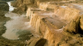
 Here’s some of that grey rock, it’s coming down the channel – your first clue. It’s all about discovery …..Twenty-five years ago, I parked near Black…
 -
 Don't try the Kelly Grade in a rainstorm. When this steep stretch of the Smoky Mountain Road is wet, its mud surface is impossibly slick. Stay in granny…
 -
 Every month this fall, KNAU has been taking you to places on the Colorado Plateau. They may be places you know, they may be places you've only heard of.…
 -
 S.P. Crater--Today on Land Lines, Michael Collier and Rose Houk take us to S.P. Crater near Flagstaff. Early cowboys gave this perfectly shaped cinder…
 -
 By Rose Houk and Michael Collierhttp://stream.publicbroadcasting.net/production/mp3/knau/local-knau-989841.mp3Meteor Crater , AZ – CLICK TO VIEW SLIDE…
 -
 By Rose Houk and Michael Collierhttp://stream.publicbroadcasting.net/production/mp3/knau/local-knau-986233.mp3Coconino, AZ – VIEW SLIDE SHOWIn the…


